New technology has given us the chance to re-examine how the Civil War battle was won and lost
By
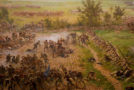
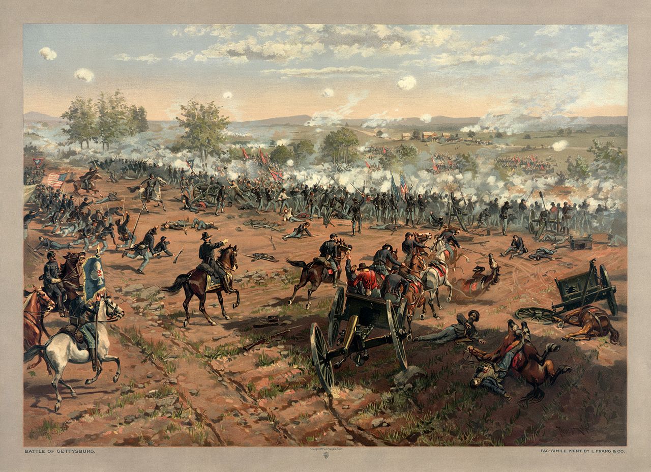
“The technological limits of surveillance during the American Civil War dictated that commanders often decided where to deploy their troops based largely on what they could see. We know that Confederate general Robert E. Lee was virtually blind at Gettysburg, as his formerly brilliant cavalry leader J.E.B. Stuart failed to inform him of Federal positions, and Confederate scouts’ reconnaissance was poor. The Confederates’ field positions, generally on lower ground than Yankee positions, further put Lee at a disadvantage. A striking contrast in visual perception came when Union Gen. Gouvernour K. Warren spotted Confederate troops from Little Round Top and called in reinforcements just in time to save the Federal line.
What more might we learn about this famous battle if we put ourselves in commanders’ shoes, using today’s digital technology to visualize the battlefield and see what they could see? Our team, which includes myself, researcher Dan Miller and cartographer Alex Tait, have done just that. Alex recreated the 1863 terrain based on a superb map of the battlefield from 1874 and present-day digital data. Dan and I captured troop positions from historical maps. Our interactive map shows Union and Confederate troop movements over the course of the battle, July 1 – 3, 1863……”